
|
Arizona is an American state located in the southwestern region of the United States of America. Arizona shares land borders with Utah to the north, the Mexican state of Sonora the south, New Mexico to the east, and Nevada to the west. Arizona shares water borders with California and the Mexican state of Baja California to the west along the Colorado River. Arizona is also one of the Four Corners states, at which Arizona touches Colorado.
|
Geographical Features of Arizona

MountainsArizona is home to hundreds of mountains ranging from around 400 meters to 3900 meters. The largest being Humphreys Peak. As displayed in the image above.
|
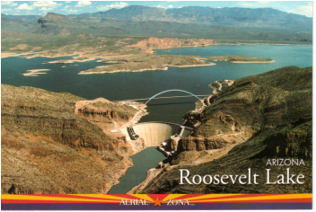
LakesIn Arizona there are many lakes, although many of them are actually man made and were created by dams. A lake in Arizona is named Roosevelt lake after the 26th president of the United States of America.
|

VolcanoesThere are many volcanoes in Arizona, in fact there are nearly 600 volcanoes in the San Francisco volcanic fields. Sunset crater being one of the youngest volcanoes in America.
|
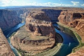
RiversThere are many rivers in Arizona including the Colorado river which connects Arizona, Baja California, California.
|
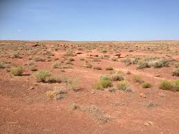
DesertsThere are four deserts in the whole of North America. Arizona is the only state in the United States where parts of all four can be found. They are the Great Basin, Mojave, Chihuahuan, and the Sonoran deserts.
|
